Mayport's working waterfront
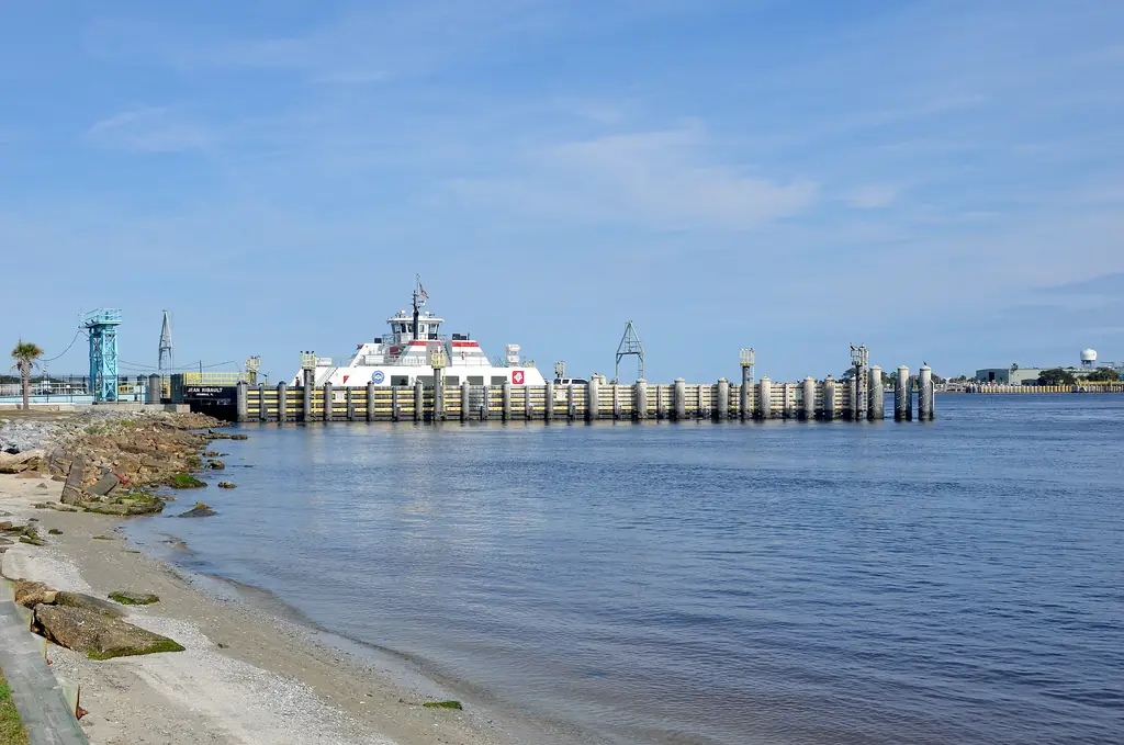
Mayport is a historic fishing village within the City of Jacksonville, on the south bank of the St. Johns River close to where it meets the Atlantic. Commercial fishing and shrimp boats tie up along its riverfront, and many waterfront parcels support seafood-related businesses, so a dock here is often a workplace first. Naval Station Mayport adjoins the village, and the St. Johns River Ferry crosses the river from Mayport to Fort George Island.
That mix shapes commercial dock project planning. Work has to fit around boats that come and go on their own schedules, a river that moves quickly near the inlet and neighbors whose operations and security needs leave little room for flexibility.
What working-waterfront dock projects need to account for
We help Mayport owners document these factors before design and bidding begin.
Boats that keep working
Fishing and shrimp boats may need to keep tying up and unloading while work proceeds. Recording vessel sizes, berthing patterns and busy periods helps contractors phase the job around the fleet.
How the dock is used
Offloading, forklift traffic, ice and product handling, and truck access all affect what a dock must support. We document current operations so your engineer can set design criteria from real use.
Bulkheads and shoreline condition
Fast water and passing wakes take a toll on bulkheads and pilings. Photos, past repair records and notes on scour, settlement or storm damage give designers a head start.
Utilities and services
Shore power, water, lighting, drainage and any fueling or ice equipment should be located and recorded so outages are planned rather than discovered.
Currents, traffic and timing near the river mouth
Conditions near the inlet make timing central to marina access and logistics in Mayport.
- Strong tidal currents near the mouth of the St. Johns can narrow the windows for safely positioning and holding barges and work boats.
- Large commercial ships use the river's navigation channel, and their passage affects work along the shoreline.
- Waters near Naval Station Mayport can be subject to security restrictions, so contractors should confirm current navigation requirements with the appropriate authorities.
- Coastal exposure makes wind, waves and storm surge major scheduling factors, especially during hurricane season from June through November.
- Fleet schedules and seasonal fishing patterns can make some months more disruptive than others for dock closures.
Landside access, staging and the ferry
Road access to Mayport comes mainly from the south and west, into a compact village with narrow streets and limited parking. Staging space on working-waterfront parcels is usually scarce because the business still needs room to operate, so laydown areas, crane positions and truck turning room should be identified early. Traffic queuing for the ferry landing adds another variable to delivery timing.
Associations and residential waterfront near Mayport
Residential associations in and around Mayport face much of the same exposure as the working waterfront, with fewer boats and more owners to inform. For HOA and condominium projects, we organize reserve study context, prior permits and condition records, and prepare a plain-language brief explaining why currents, wakes and storm exposure matter to scope, cost and schedule.
Services for Mayport properties
Commercial and complex-project planning suits working-waterfront owners who need to settle scope, phasing and operational constraints before engaging designers. Access and logistics questionnaires capture currents, staging, ferry-area traffic and vessel schedules for bidders, and commercial project documentation keeps condition records and decisions organized for owners, insurers and future work.